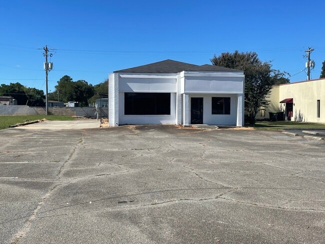
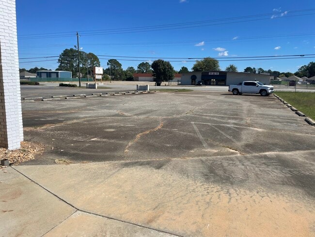
Property Record
1041 N Houston Rd, Warner Robins, GA 31093
NEARBY LISTINGS FOR SALE OR LEASE
Property Detail
1041 N Houston Rd
Warner Robins, GA
N Houston Rd 500 Ff
0W071031A000
PARCEL 10-A PB 32/187 163/5TH
Commercialacreage
Houston
X
Georgia
13021C0245G
10
2024
0.28 AC
2024
Perry/Warner Robins
020111
Other Market Areas
DEMOGRAPHICS near 1041 N Houston Rd
1 Mile
3 Mile
5 Mile
2024 Total Population
8,760
43,626
86,918
2029 Population
9,548
47,891
95,188
Pop Growth 2024-2029
+ 9.00%
+ 9.78%
+ 9.51%
Average Age
38
38
38
2024 Total Households
3,605
17,389
34,763
HH Growth 2024-2029
+ 8.71%
+ 9.55%
+ 9.37%
Median Household Inc
$53,164
$50,493
$57,157
Avg Household Size
2.30
2.40
2.40
2024 Avg HH Vehicles
2.00
2.00
2.00
Median Home Value
$113,793
$109,927
$136,290
Median Year Built
1978
1974
1983
Nearby Places
Map Layers
Map Styles
 Street
 Aerial
- Restaurants
- Banks
- Shops
- Fitness
- Groceries
SALE & LEASE HISTORY
LISTING DATE
SALE/LEASE

Nov 11, 2024
For Lease
Nov 08, 2024
For Sale
May 04, 2022
For Lease
Mar 05, 2024
For Lease
Dec 30, 2019
For Sale
Apr 20, 2021
For Lease
Apr 20, 2021
For Sale
Apr 06, 2020
For Lease
Nearby Properties
Address
Land Use
TOTAL SIZE
Lot Size
Zoning
Address
Land Use
TOTAL SIZE
Lot Size
Zoning
780,000 SF
70.50 AC
M-2
Address
Land Use
TOTAL SIZE
Lot Size
Zoning
88,965 SF
18.72 AC
R2
Address
Land Use
TOTAL SIZE
Lot Size
Zoning
11,658 SF
30.23 AC
R2
Address
Land Use
TOTAL SIZE
Lot Size
Zoning
304,246 SF
23.11 AC
C2
Address
Land Use
TOTAL SIZE
Lot Size
Zoning
92,930 SF
18.66 AC
C2
Address
Land Use
TOTAL SIZE
Lot Size
Zoning
21,750 SF
11.48 AC
C2
Address
Land Use
TOTAL SIZE
Lot Size
Zoning
223,608 SF
22.40 AC
C2
Address
Land Use
TOTAL SIZE
Lot Size
Zoning
11,200 SF
7.60 AC
R4
Address
Land Use
TOTAL SIZE
Lot Size
Zoning
6,336 SF
27.16 AC
R4
Address
Land Use
TOTAL SIZE
Lot Size
Zoning
194,390 SF
242 AC
A
Address
Land Use
TOTAL SIZE
Lot Size
Zoning
128,540 SF
32.26 AC
R2
Address
Land Use
TOTAL SIZE
Lot Size
Zoning
139,016 SF
24.71 AC
C2
Address
Land Use
TOTAL SIZE
Lot Size
Zoning
132,851 SF
24.05 AC
C2
Address
Land Use
TOTAL SIZE
Lot Size
Zoning
90,000 SF
12 AC
R1
Address
Land Use
TOTAL SIZE
Lot Size
Zoning
61,628 SF
45 AC
C2
Address
Land Use
TOTAL SIZE
Lot Size
Zoning
121,500 SF
10 AC
R2
Address
Land Use
TOTAL SIZE
Lot Size
Zoning
93,450 SF
11.16 AC
R2
Address
Land Use
TOTAL SIZE
Lot Size
Zoning
60,000 SF
8.95 AC
C3
Address
Land Use
TOTAL SIZE
Lot Size
Zoning
16,576 SF
13.47 AC
R4
Address
Land Use
TOTAL SIZE
Lot Size
Zoning
1,512 SF
309.01 AC
M2
Address
Land Use
TOTAL SIZE
Lot Size
Zoning
31,797 SF
9.45 AC
R2
Address
Land Use
TOTAL SIZE
Lot Size
Zoning
71,434 SF
10.58 AC
R2
Address
Land Use
TOTAL SIZE
Lot Size
Zoning
5,400 SF
16.21 AC
R4
Address
Land Use
TOTAL SIZE
Lot Size
Zoning
108,500 SF
10.85 AC
C2
Address
Land Use
TOTAL SIZE
Lot Size
Zoning
8,752 SF
11.71 AC
R4
Address
Land Use
TOTAL SIZE
Lot Size
Zoning
75,613 SF
11.51 AC
C1
Address
Land Use
TOTAL SIZE
Lot Size
Zoning
4,720 SF
12.53 AC
C2
Address
Land Use
TOTAL SIZE
Lot Size
Zoning
108,075 SF
10.55 AC
R2
Address
Land Use
TOTAL SIZE
Lot Size
Zoning
90,000 SF
9.20 AC
R2
Address
Land Use
TOTAL SIZE
Lot Size
Zoning
22,500 SF
9.80 AC
R2
The World's #1 Commercial Real Estate Marketplace
Connect with us
© 2025 CoStar Group
The information above has been obtained from sources believed reliable. While we do not doubt its accuracy we have not verified it and make no guarantee, warranty or representation about it. It is your responsibility to independently confirm its accuracy and completeness. Any projections, opinions, assumptions, or estimates used are for example only and do not represent the current or future performance of the property. The value of this transaction to you depends on tax and other factors which should be evaluated by your tax, financial, and legal advisors. You and your advisors should conduct a careful, independent investigation of the property to determine to your satisfaction the suitability of the property for your needs.